
By Dustin Trummer
Understanding how to read deer terrain separates guesswork from strategy. Knowing where to hunt is just as important as knowing how to hunt. Great stand locations come from reading terrain features, not luck. Whether you’re using deer topographic maps or digital mapping apps, learning to interpret elevation, wind, and cover gives you a massive advantage in the field. The landscape itself tells a story—of how deer move, where they feel secure, and why they travel certain paths. The more time you spend learning terrain, the more invisible you become to your quarry.
Understanding Topographic Maps for Deer Hunting
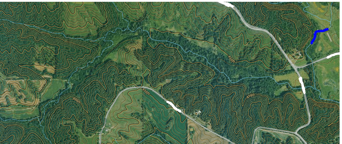
Deer topographic maps use contour lines to represent elevation. These lines tell you where deer travel, bed, and feed. The closer the lines, the steeper the terrain; the wider the spacing, the gentler the slope. By analyzing these shapes, hunters can identify key funnels, ridges, and valleys that naturally direct deer movement. Every bend, saddle, or ridge holds a clue. Once you understand what those lines mean in real-world terrain, the woods start to make sense in a way few hunters ever experience.

Before stepping into the woods, study a few topo maps of your area. Trace the contour lines with your finger to visualize the landscape. Identify ridgelines, draws, and drainages. This practice alone can save you days of scouting and dozens of empty sits. If you can locate where terrain features converge—like a saddle feeding into a drainage—you’ve already found a natural funnel that deer instinctively use year after year.
Saddles — Natural Deer Highways
Saddles are the low points between two ridges and one of the most reliable terrain features for deer hunting. Deer instinctively take the path of least resistance, using saddles as travel corridors between feeding and bedding areas. These spots are especially productive during the rut when bucks cruise from one ridge system to another in search of does. When reading terrain features for deer hunting, saddles almost always top the list. They’re like nature’s highways for whitetails, quietly connecting everything they need without exposing them to danger.

When scouting saddles, look for fresh tracks and rub lines that lead into the low point. In hill country, deer prefer to travel through the deepest part of the saddle where they can remain unseen while conserving energy. If you can find a saddle bordered by thick cover or located between bedding and a destination food source, you’ve found a high-percentage hunting spot. Place your stand downwind and slightly off the main trail for the best shot opportunities.
Ridge Lines & Spur Ridges — Elevated Travel Routes
Ridge lines and spur ridges act as the whitetail’s superhighways. Deer use these elevated routes to move between bedding and feeding areas while maintaining wind advantage. On your map, look for long, narrow hilltops—these are primary ridges. Smaller fingers branching off are spur ridges. Deer often bed on the leeward side of these features to catch thermals rising from below and wind currents from above, giving them a 360-degree defense system.

In most areas, prevailing winds come from the west, which means deer frequently bed on eastern slopes. They can use wind from behind and thermals from the valley to monitor both upwind and downwind threats. This is why ridge lines are such effective ambush points—especially when paired with a nearby saddle or bench. Position your stand on the downwind edge where thermals and wind intersect. That’s where bucks feel safest traveling during daylight hours.
Benches — Hidden Bedding Gold
Benches are flatter sections along hillsides that create natural resting areas and travel routes. To an untrained eye, they might look insignificant, but to a deer, they’re perfect. These zones offer comfort, concealment, and quick escape routes. On deer topographic maps, benches appear as wider contour spacing mid-slope. Larger benches make great bedding areas, while smaller ones often link bedding to feeding areas. If you can locate a bench with nearby water or acorns, it’s likely to see steady deer use.

Benches shine during early season and pre-rut phases when deer are on consistent patterns. You can often find rub clusters on benches where bucks stage before entering feeding areas at dusk. These are perfect places for a well-hidden stand, especially when combined with thick cover and a favorable wind direction.
Creek Crossings — Funnels You Can Trust
Deer prefer easy crossing points along creeks and rivers. Waterways serve as both obstacles and navigation lines in their daily travel. Look for gentle banks where contour lines widen near water—these areas indicate easier crossings. A single creek crossing can funnel multiple trails into one narrow choke point, giving bowhunters predictable shot opportunities. Combine deer topographic maps with aerial imagery to locate the shallowest or narrowest crossing zones.

When scouting, look for hoofprints entering and exiting the creek. You may also find trails paralleling the waterway with several small breaks where deer can cross easily. These “hot spots” are great for mobile setups, especially during early mornings and evenings when deer are on the move.
Thermal Hubs & Drainages — The Whitetail’s Scent Advantage
Thermal hubs are areas where multiple valleys or drainages meet. These are low-lying bowls that act like scent-collection zones. Mature bucks love them because they can sit tight while the wind and thermals carry scents from all directions. Learning how to read deer terrain means understanding how air and scent move, not just how the ground lays. When the morning thermals rise, scent from below flows up into the hub. When the evening cools, thermals drop and pull scent back down. Bucks use this to monitor an entire hillside without ever leaving cover.

To hunt a thermal hub, avoid setting up directly in the bottom. Instead, position yourself on the downwind edge or slightly above where multiple drainages converge. Monitor shifting thermals throughout the day and hunt only when the wind is stable. These setups are advanced but deadly when executed correctly.
How to Combine Topo Maps and Aerial Imagery
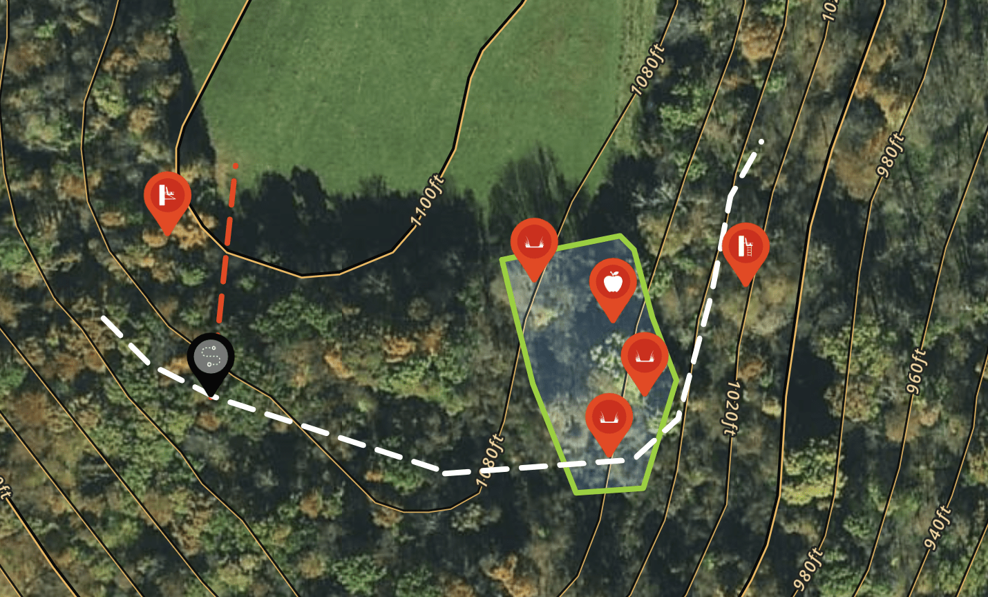
Modern mapping tools like OnX, HuntStand, and Google Earth let you overlay deer topographic maps with aerial imagery. This gives you a full 3D understanding of how terrain, food, and cover interact. Start by marking known food sources—ag fields, oak flats, or clearcuts. Then trace the terrain funnels that connect them to bedding cover. Every feature you’ve learned—saddles, ridges, benches, and drainages—should appear somewhere along those paths. Those intersections are your highest-value ambush points.
Using Terrain Features to Plan Hunts
- Mark saddles and benches as travel or bedding areas.
- Identify ridgelines for morning and midday travel routes.
- Locate creek crossings for evening ambush setups.
- Use thermal hubs as scent-checking zones for mature bucks.
- Overlay aerial photos to find nearby food, water, and cover.
Applying Map Knowledge in the Field
After studying maps, it’s time to put boots on the ground. Walk your predicted travel corridors and confirm fresh sign like rubs, scrapes, and droppings. Note how the wind behaves in those areas—it often shifts differently than you’d expect from the map alone. Adjust stand setups based on real-world wind and thermal behavior. The more you practice reading terrain for deer hunting, the faster you’ll start predicting movement before it happens. It’s a skill that compounds every season, sharpening your intuition and efficiency in the woods.
Pro Tip: Use Historical Data
Save your map layers, pins, and photos year over year. Over time, you’ll see repeat travel corridors and seasonal bedding patterns tied directly to topography. Use this data to fine-tune access routes and stand locations. As you grow your experience, you’ll begin to see terrain not as an obstacle, but as your greatest ally in understanding deer behavior.
Want to dive deeper into e-scouting and terrain analysis? Check out this detailed guide from GOHUNT on analyzing terrain when e-scouting — it’s packed with practical map-reading insights that apply to both mule deer and whitetail hunters.
By mastering these terrain-reading skills, you’ll start to see patterns in how deer use the landscape, giving you a major advantage over the competition.
🔗 This post is part of the Deer Hunting for Beginners Series—your full guide to mastering the basics of whitetail hunting.
📘 Stay tuned for the next post in series: “Hunting Funnels and Mistakes to Avoid: Lessons from the field”.

Leave a Reply